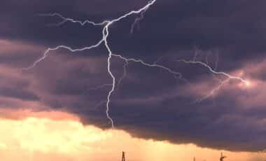
At least four people have died following a destructive outbreak of severe weather sweeping across the Midwest and into the Northeast, bringing reports of multiple tornadoes, destructive winds and giant hail. The same system is now advancing eastward, threatening further damage as it interacts with a widespread and dangerous heat wave affecting more than 150 million people.
Forecasters warn the storm complex could continue producing destructive conditions as it moves through the Great Lakes and into New England, potentially evolving into a derecho – a long-lived, fast-moving windstorm often described as an “inland hurricane.” The threat is compounded by intense heat across much of the eastern United States, with many areas expected to endure several consecutive days above 90°F (32°C).
Fatalities and Damage Reported in Dakotas and New York
According to the Cass County Sheriff’s Office, three people were killed late on 20 June in rural Enderlin, southeastern North Dakota, after a reported tornado struck their home. Sheriff Jesse Jahner stated that the property was “totally destroyed” and confirmed that storm chasers found two victims at one location, with a third person discovered elsewhere. Deputies also reported significant damage to other homes, including one with its roof torn off.
A fourth fatality was recorded in Clinton, New York, when a large tree fell on a moving vehicle during strong winds, according to the National Weather Service (NWS) office in Burlington, Vermont. The 20 June storms produced wind gusts up to 101 mph (162 km/h) near Linton, North Dakota, along with hailstones exceeding 3.5 inches (9 cm) in diameter, according to preliminary reports from the Storm Prediction Center. More than 75,000 power outages were reported across North Dakota and Minnesota on the morning of 21 June.
‘Ring of Fire’ Fuels Eastward March of Severe Weather
Meteorologists at the Weather Prediction Center describe the system as part of a “ring of fire” pattern, created by a high-pressure dome over the southeastern United States that circulates warm, moisture-laden air around its periphery. Bryan Jackson, a meteorologist with the centre, explained that this setup is common in peak summer and favours the development of powerful thunderstorm clusters along the outer edges of the heat dome.
According to AccuWeather, thunderstorms forming on the boundary of the dome are likely to intensify as they move east, with the potential to consolidate into a derecho. This same pattern is responsible for drawing in moisture from the Eastern Pacific, which has been active with tropical systems in recent days, adding to the instability in the atmosphere.
Meanwhile, the NWS has placed over two dozen states under excessive heat warnings or advisories, with temperatures expected to reach triple digits in parts of Kansas, Nebraska and southwestern Minnesota. Major East Coast cities, including New York and Washington, D.C., could face five to seven consecutive days of 90°F-plus heat, increasing the risk of heat-related illnesses and placing additional strain on energy systems.