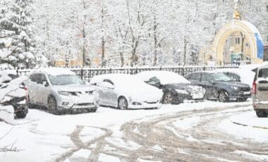
As the festive season draws near, the UK is preparing for what could be a particularly cold and snowy Christmas. According to the latest weather maps, significant snowfall is expected in several regions, especially in Scotland and the North of England, with some areas seeing considerable snow accumulation.
Widespread Snowfall Forecast Across the Country
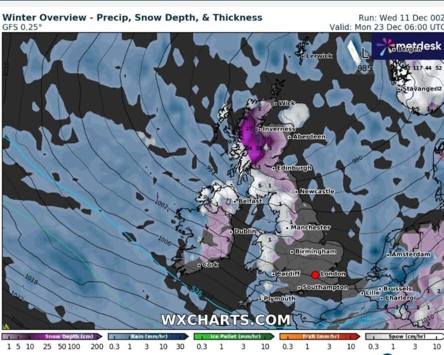
The latest weather maps, provided by WXCharts, predict snowfall over a wide swathe of the UK, with areas in Scotland and the north of England expected to experience the most extreme conditions.
- Scotland: Major cities such as Edinburgh and Glasgow could see snowfalls of up to 3 cm per hour, with particularly severe conditions in the middle of the day. The snow is expected to continue falling throughout the day on 25 December, blanketing cities in a thick blanket of snow.
- Northern England: Areas like Newcastle and the north-east of England are also expected to experience similar snowfall rates, with accumulations reaching 3 cm per hour.
- WXCharts has indicated that these snowfall zones will be marked by purple and white areas on their maps, indicating heavy snowfall and very cold conditions, particularly during the morning hours.
These forecasts are based on detailed analyses of the current weather conditions and short-term weather models, showing cold fronts pushing Arctic air southwards.
A Cold Snap with Intense Snowfall
In addition to the snow, the UK is bracing for a particularly harsh cold snap, which will affect Scotland the most, where the conditions will be at their most extreme.
- Scotland: Snowfall rates of up to 6 cm per hour are expected in areas like the Highlands, with cities such as Inverness also facing heavy snow. Temperatures in these regions could drop to as low as -3°C, with wind chill making it feel even colder.
- Northern England: In cities like Manchester and Newcastle, snow will mix with rain, forming a thin layer of ice on the roads.
- Cities Affected by Snow: The Yorkshire and Lancashire regions are also expected to see significant snow accumulation, which could lead to difficult driving conditions.
“Particularly challenging conditions are anticipated,” warned experts from Met Desk, with their snow and temperature maps confirming heavy snow accumulation in parts of the country.
Rainfall and Varied Conditions for Other Areas
While the snow will dominate in the north and west of the country, other regions will experience less extreme conditions, although still subject to unsettled weather.
- Wales: The north of Wales will see significant rainfall, with up to 10 mm per hour expected in some areas, which could cause localised flooding.
- South of England: London and areas in the south of England may remain mostly dry, but light snow is still a possibility, with rain predicted for much of the day. Rainfall rates are expected to be around 2 mm per hour, which could disrupt travel but will not cause the same severity as in the north.
Cardiff, the capital of Wales, may also be affected by heavy rain, with warnings issued for areas prone to flooding. These conditions are likely to persist throughout the Christmas period.
Freezing Temperatures Expected
Temperatures are set to drop significantly, especially in the northern parts of the country. The forecasts indicate that wind chill could make conditions feel even colder than the actual temperature, particularly in elevated areas of Scotland.
- Scotland: In Edinburgh, temperatures are expected to hover around -1°C on Christmas Day, with wind chills making it feel as cold as -5°C. Inverness could see temperatures drop to as low as -3°C.
- Southern Regions: Cities such as Bristol and London will experience milder temperatures around 3°C, but the wind will make it feel colder.
Temperatures will likely remain low across the UK in the lead-up to Christmas, with the south of England experiencing relatively mild conditions compared to the rest of the country.
An Uncertain Outlook for the End of the Year
Longer-term forecasts indicate continued instability throughout the final days of December. Experts from Met Office have suggested that the weather may remain volatile, with calmer spells in the south but more extreme conditions expected in the north.
- North of the UK: Snow will continue intermittently, particularly in the north-west and Scotland, where temperatures will remain well below seasonal averages.
- Southern Regions: While the south will be spared from heavy snow, periods of rain and strong winds are likely to affect these areas.
The Met Office has also predicted strong winds to accompany the snow in coastal areas, with gusts reaching up to 50mph (80.47 km/h) in some locations.





Bullshit they say this ever year