Australia is experiencing a dramatic shift as it enters the first week of winter, following an unusually warm autumn that ranked as the fourth warmest on record. The country faces a series of cold fronts bringing heavy rain, severe thunderstorms, and dropping temperatures, particularly affecting southwestern Western Australia, Tasmania, and southeastern mainland Australia. This weather pattern poses challenges for residents, agriculture, and infrastructure as the region adjusts to rapidly changing conditions.
The arrival of this severe weather follows months of warmth, with meteorologists emphasizing the importance of preparedness. Understanding the nature and impact of these weather events is vital for communities likely to be affected in the coming days.
Severe Thunderstorms and Heavy Rain Threaten Southwestern Australia
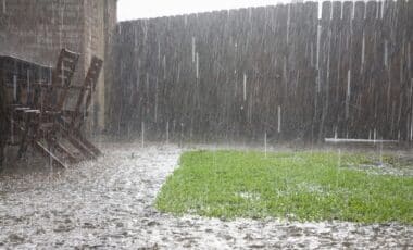
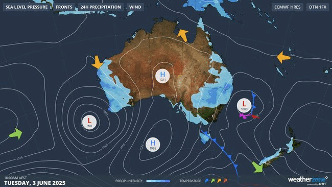
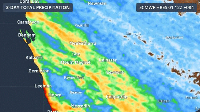
A weather system is advancing towards the west coast of Western Australia, bringing intense rain and thunderstorms from the Pilbara and Gascoyne regions down to the southern districts of the state. Bureau of Meteorology meteorologist Angus Hines warned of the risk of severe thunderstorms on Monday, highlighting the potential for damaging wind gusts. These winds may cause trees to fall onto vehicles and properties, disrupt power supplies, and increase the risk of flash flooding.
The wet and stormy conditions are expected to continue beyond Monday, extending through Tuesday and into Wednesday. Rainfall totals are predicted to range between 50mm and 100mm from Perth to the far southwest coast. Despite the precipitation, Perth’s maximum temperatures will remain relatively mild, hovering around 20 to 21 degrees Celsius.
Winter Cold Fronts Bring Chilly Winds and Changing Conditions to Tasmania and Southeast Australia
Two distinct cold systems are forecast to move through Tasmania and southeastern mainland Australia during the week, introducing a marked drop in temperatures accompanied by strong southerly winds. Senior Meteorologist Rob Sharpe noted the significant cooling set to occur, with Victoria and Tasmania experiencing much colder weather by Tuesday, spreading across southeastern Australia by Wednesday.
Victoria may also experience thunderstorms on Monday, Tuesday, and Wednesday, while northeastern New South Wales faces showers and some of the lowest maximum temperatures so far this year. The Bureau of Meteorology has issued warnings for sheep graziers in parts of the Snowy Mountains due to cold conditions that may threaten livestock. Additionally, marine wind warnings are in effect for several locations along the New South Wales coast on Tuesday.
Advancing Polar Air Mass Expected to Bring Snow and Further Cold Outbreaks
A second cold front, featuring a polar air mass, is expected to reach southeastern Australia over the weekend, bringing snow to the highest parts of the mainland on Saturday. This will be followed by a more intense cold outbreak later Sunday and into Monday, intensifying the wintry conditions in the region.
City forecasts reflect this cooling trend: Sydney is expected to see a high of 16°C on Tuesday, with south-westerly winds and evening showers. Canberra will experience morning lows near 1°C, warming to 17°C by midday. Melbourne faces a cold, cloudy day with a high of 14°C and a high likelihood of showers. Hobart is predicted to be cooler, with a maximum of 12°C and a moderate chance of rain.
Meanwhile, Brisbane is forecast for a mostly sunny day after slight morning showers, with temperatures reaching 25°C. Darwin is expected to remain warm and sunny, with highs around 31°C.