Australia is preparing for a wet weather finish to the year, as the Indian Ocean Dipole (IOD), a major climate driver, emerges after three years of absence. This climatic shift could result in increased rainfall across large parts of the country, particularly heading into the spring months. The negative phase of the IOD, which typically brings more moisture to Australia, is showing early signs of development.
According to ABC News, this shift in ocean temperatures could lead to wetter conditions in the coming months, though the exact impacts will depend on how the event unfolds. The full extent of the changes will become clearer over time.
What is the Indian Ocean Dipole?
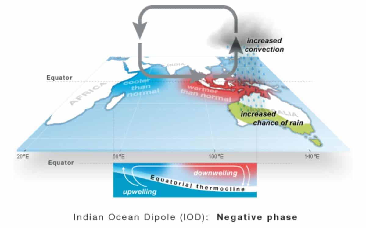
The Indian Ocean Dipole is a climate phenomenon that has a significant impact on Australia’s weather patterns. It refers to a difference in sea surface temperatures between the western and eastern parts of the Indian Ocean.
A negative IOD, which is the wet phase, has been linked to some of Australia’s wettest winters and springs on record, such as those in 2010, 2016, 2021, and 2022. These events are responsible for some of the wettest weather in the country’s history.
The Current Negative IOD Event
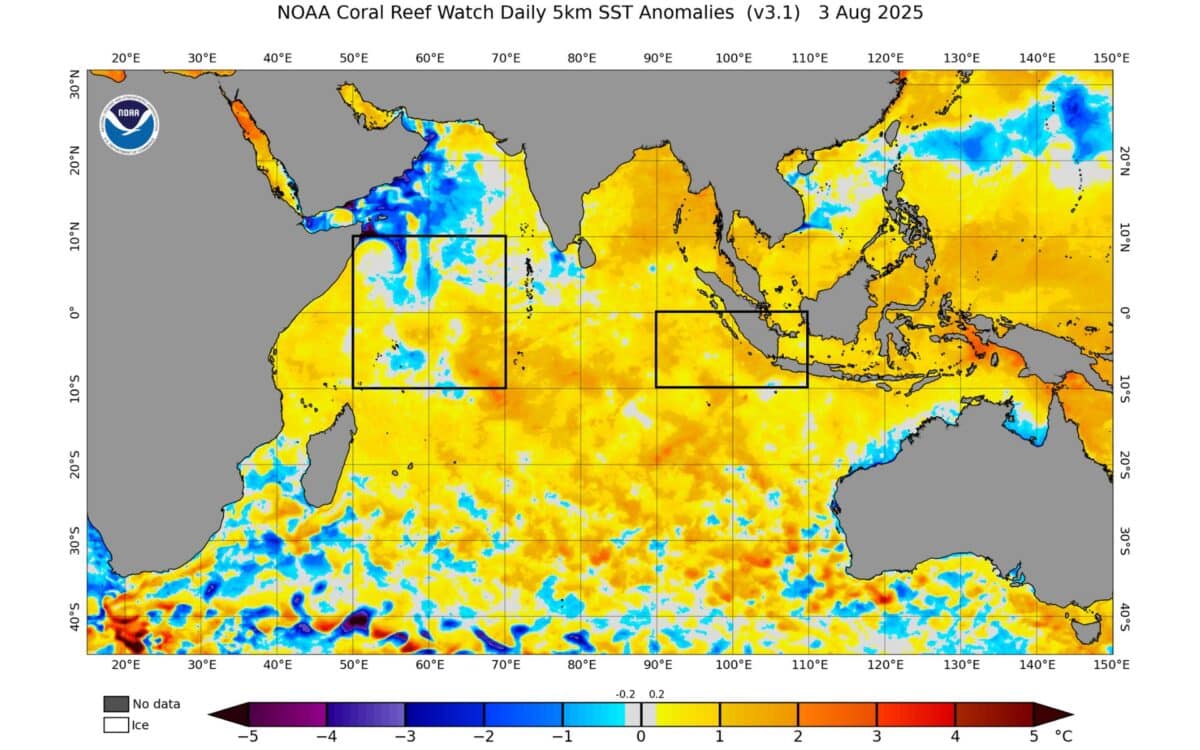
Recent changes in ocean temperatures indicate the development of a negative IOD for the first time since 2022. This shift is marked by warmer waters near Indonesia and cooler waters off the Horn of Africa, promoting the influx of moist air towards Australia. This pattern is comparable to the La Niña phase of the Pacific Ocean, which also brings increased rainfall to the region.
The index used to measure the state of the Indian Ocean has recently registered a value of -0.6°C, below the threshold of a negative IOD of -0.4°C for two consecutive weeks. For 2025 to officially be classified as a negative IOD year, this index must remain below -0.4°C for at least another six weeks.
The latest forecast suggests that the index could drop to approximately -1°C in September before gradually returning to neutral by December, providing ample time to influence Australia’s weather patterns.
Potential Impacts on Australia’s Weather
Typically, a negative IOD results in significantly higher rainfall during winter and spring. In fact, national average rainfall during a negative IOD event is typically 36% higher during spring than in neutral years, based on 13 negative IOD events between 1960 and 2024.
The Bureau of Meteorology (BOM) predicts a 70 to 80% chance of above-median rainfall across central and eastern Australia in the coming months, aligning closely with the typical wet weather footprint of a negative IOD.
In winter, the increase in precipitation averages 20%, and by summer, this impact decreases to 13.9%. The wet weather pattern is expected to be particularly pronounced in the southeast inland, where precipitation levels are consistently in the 9th decile, meaning rainfall totals are in the top 20% of all years.
However, not all events are the same, and the presence of other climate drivers, such as La Niña, may mean that the wet weather in 2025 may not be as widespread or intense as in past years.
Temperature Trends in the Coming Months
In addition to increased rainfall, a negative IOD can also influence temperatures. While climate change generally increases the overall warmth of Australian seasons, the additional cloud cover from extended wet periods can lower daytime temperatures.
The BOM’s latest outlook predicts below-median maximum temperatures in parts of central and eastern Australia from August to November due to the wet weather and increased cloud cover.