Extreme spring weather lashed eastern Australia this week, bringing severe thunderstorms, record rainfall and rare tornado activity to parts of New South Wales. Sydney alone recorded 122mm of rain in just 24 hours—its highest September total in 146 years.
Two confirmed tornadoes touched down in the state’s west on Wednesday, while coastal regions battled flooding rains, dangerous surf and damaging winds. The rare event unfolded as a low-pressure system intensified over NSW, triggering a complex chain of atmospheric phenomena.
A Rare Atmospheric Convergence Triggers Violent Spring Weather
Eastern Australia is no stranger to extreme weather, but meteorologists say the events of the past 24 hours stand out in their intensity and timing. On Wednesday afternoon, two tornadoes struck the central west region of New South Wales, the first near Caragabal around 2:30pm, followed by another near Young an hour later. These tornadoes were spawned by isolated supercell thunderstorms, fuelled by an unusual overlap of warm, humid surface air and frigid upper-atmosphere conditions.
According to the Bureau of Meteorology (BOM), strong wind shear and a powerful updraft were the key ingredients. At the time, surface winds were blowing lightly from the north-east, while just two kilometres above, winds from the north-west were clocked at nearly 100km/h. This opposing airflow created the rotational energy needed to generate tornadoes.
Tornadoes in Australia are often under-reported due to the vastness of the landscape and sparse population in inland areas. The BOM estimates around 30 to 80 occur each year, although only 10 to 20 are typically sighted. Despite their rarity, tornadoes can be highly destructive: the Bucca tornado of 1992 remains the country’s most intense on record, classified as an F4.
Sydney Drenched in Record-Breaking Rainfall
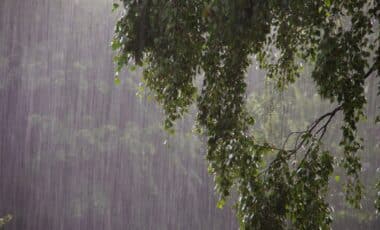
While tornadoes formed inland, the east coast endured a separate assault from the same system. In just one day, Sydney received 122mm of rainfall—its heaviest September day since 1879, according to BOM rainfall data. The downpour exceeded twice the average monthly rainfall in under 24 hours, inundating suburbs and overwhelming local drainage systems.
Other locations recorded similarly exceptional figures. Randwick received 146mm, the highest total in September since records began in 1888. Ulladulla saw 145mm, the heaviest in at least 30 years. Kiama and Bellambi also broke longstanding records.
Sydney’s wet start to spring follows a historically wet August. The city’s 2025 rainfall total has now surpassed 1,540mm, already placing it more than 300mm above the yearly average with over three months to go. Offshore, the system also stirred up dangerous surf, with waves topping 9.6 metres off the Sydney coast.
While conditions have since eased, the impacts—flash flooding, infrastructure damage, and disrupted transport—will take longer to clear. The recent convergence of meteorological extremes offers a stark reminder of Australia’s volatile spring climate.