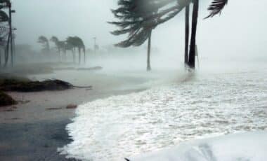
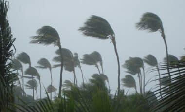
South-east Queensland is facing a new wave of severe weather after a powerful east coast low moved north from New South Wales, bringing cyclonic winds, cold temperatures, and widespread disruption. The storm system has already impacted tens of thousands of residents across Brisbane and surrounding areas, with authorities responding to a range of weather-related emergencies.
While conditions have begun to improve across the NSW coastline, the low-pressure system’s northward movement has shifted the risk to Queensland. Meteorologists are warning of continued hazardous weather as the storm travels further inland, triggering cold air masses, wind damage, and significant service disruptions.
Power Outages and Flight Cancellations as Winds Intensify
Throughout Wednesday, 41,000 homes and businesses across south-east Queensland experienced power cuts as winds downed trees and powerlines. According to local authorities, at least 13,000 properties were still without electricity by nightfall. Utility crews have been deployed across the region to begin emergency repairs, but full restoration is expected to take time due to extensive damage to infrastructure.
Brisbane Airport reported gusts of up to 75 km/h, while Cape Moreton and Redland recorded winds near 61 km/h. The strong gusts disrupted air traffic, leading to more than a dozen flight cancellations in and out of Brisbane. Queensland’s energy providers and emergency services remain on high alert as forecasts predict ongoing severe gusts overnight.
Severe Weather Sparks Near Misses and Safety Concerns for Residents
In Narangba, a suburb in the Moreton Bay region, a woman and her baby escaped uninjured after a gum tree fell onto their car. Emergency services responded quickly, highlighting the growing safety risks posed by falling trees and windborne debris. Elsewhere, a trampoline was lifted into the air and landed in a backyard in Brisbane’s north-east, illustrating the erratic behavior of high wind events.
Local councils have urged residents to secure loose objects and stay indoors during peak gust periods. Queensland Police and SES crews have received a surge in calls related to fallen branches, property damage, and road hazards, with some minor road closures reported due to storm debris.
Inland Regions Hit by Cold Temperatures and Wind Chill
The coastal low also brought an unexpected drop in temperatures across Queensland’s inland regions. In Toowoomba, temperatures fell to 0.7°C, with the wind chill making it feel as low as -5.5°C. In Oakey, the recorded temperature was 2.8°C, but wind conditions pushed the perceived temperature to -3.6°C.
These low temperatures, unusual for the region even in winter, have raised concerns among emergency services about exposure risks for vulnerable populations, including the elderly and homeless. Weather experts suggest the cold air mass is being driven northward by the low-pressure system’s circulation pattern, compounding the impact of the event across multiple regions.
Recovery Efforts Underway as Forecasts Remain Uncertain
As the weather system continues to move along the Queensland coast, local authorities are focusing on immediate recovery and damage assessment. Power restoration teams are working through difficult conditions, while airport operations remain subject to further delays depending on wind conditions.
The Bureau of Meteorology’s Baden Gilbert has confirmed that the weather system is weakening slowly but remains capable of producing damaging gusts, coastal erosion, and heavy rain in some areas. Queensland residents are advised to monitor official updates and avoid travel unless necessary.
State Services Monitor Ongoing Threat
Queensland’s emergency management teams remain active as the situation develops. The storm follows similar patterns to previous east coast lows, known for creating intense, localized weather patterns as they travel offshore. While New South Wales avoided further escalation, Queensland’s south-east is now bearing the brunt of the storm’s force.
With meteorologists continuing to track the system’s trajectory, the next 24 hours will be critical in determining how much further impact the storm will have inland. Regional alerts remain in place, and residents are being encouraged to prepare for potential power loss and continued wind hazards through the night.


