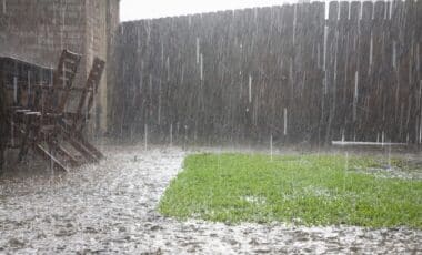
The east coast of new south wales (nsw) is bracing for a major winter storm as meteorologists track a powerful weather system known as the “beast from the east.” This event is expected to bring days of heavy rainfall, damaging winds, and hazardous surf conditions stretching from sydney to the mid north coast, potentially impacting millions of residents.
Weather experts have warned that this system could become one of the most significant events of the season. With multiple embedded low-pressure systems fueling prolonged periods of strong onshore winds and high seas, authorities are urging coastal communities to prepare for severe conditions beginning this weekend.
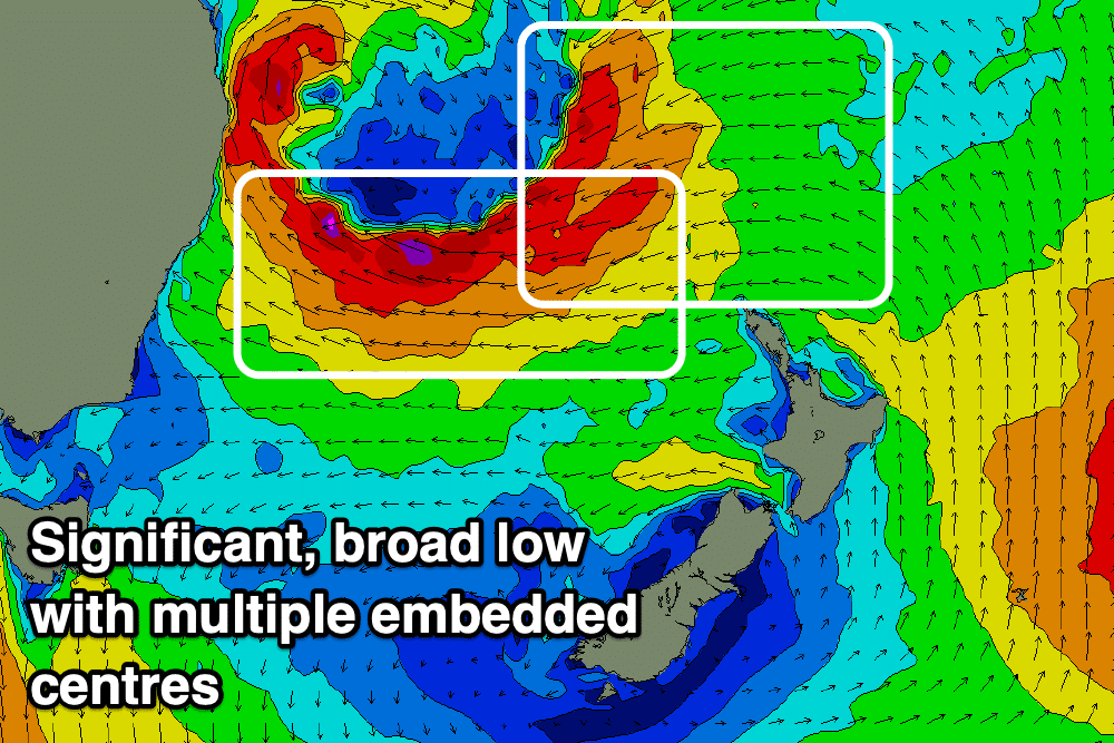
A Rare Atmospheric Setup Behind the Storm
The storm’s development is linked to an upper-level trough pushing eastward across australia, combined with a cold outbreak originating in western australia. These elements are forecast to interact off the mid north coast, where a large low-pressure system is expected to form on saturday.
Meteorologists at swellnet describe this system as unusual because of the presence of multiple embedded lows within the broader circulation. This rare configuration will generate several overlapping wind fetches, leading to gale to severe-gale-force winds that could persist for days, significantly intensifying wave activity along the nsw coastline.
Forecast for Prolonged Heavy Rain and Strong Winds
According to the bureau of meteorology (bom), rainfall will intensify across coastal areas from saturday, with heavier falls expected to continue into early next week. Onshore winds will increase the risk of localized flooding, particularly in low-lying areas between sydney and the mid north coast.
Residents are also being warned about the potential for dangerous coastal conditions. With the storm deepening, wave heights are forecast to rise sharply, creating serious hazards for mariners and beachgoers. Authorities have advised against entering the water or traveling near exposed coastal locations during the height of the storm.

Hazardous Surf Conditions and Coastal Impacts
The overlapping wind patterns associated with the storm will produce xl surf conditions from late sunday into monday. Swell models from both the european centre for medium-range weather forecasts (ecmwf) and the global forecast system (gfs) indicate that wave heights could reach dangerous levels, particularly along the central coast and northern beaches.
These conditions pose a significant threat of coastal erosion in vulnerable areas. The combination of strong winds, high tides, and powerful surf may damage beachfront infrastructure and reshape sections of the shoreline, compounding risks for local communities already exposed to winter storm activity.
Improving Surf Outlook Early Next Week
While the initial phase of the storm will be marked by extreme onshore conditions, a shift in the weather pattern is expected early next week. Meteorologists predict that offshore winds could develop from late monday into tuesday, helping to organize the large swell and improve surf quality for experienced surfers.
Despite this temporary improvement, forecasters warn that the underlying weather pattern remains active, with the potential for additional storm systems to form in the region over the coming weeks. Coastal residents and businesses are being urged to monitor updates closely and remain alert to any changes in official forecasts.