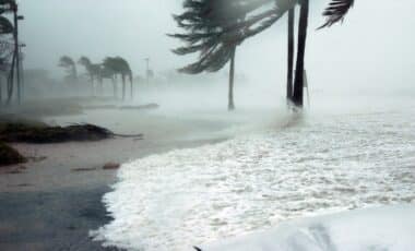
Storm system brewing off the coast of New South Wales (NSW) could develop into an East Coast Low (ECL) by early July. This low-pressure system is expected to bring severe weather conditions, including heavy rainfall, intense winds, and large waves, impacting coastal regions across the state. Experts warn that the impact could be substantial, given the historical significance of similar events.
East Coast Lows are notorious for their ability to create dangerous conditions for coastal communities. These rapidly developing systems are typically characterized by long-lasting, severe weather that can persist for over 24 hours. In past years, East Coast Lows have caused extensive flooding, strong winds, and coastal erosion, notably during the storms of June 2007 and 2016. As the weather system intensifies, there are growing concerns about its potential to deliver damaging weather over the coming week.
What is an East Coast Low?
An East Coast Low (ECL) is a specific type of low-pressure system that forms along the east coast of Australia. These systems are unique because they develop quickly and can remain in the area for an extended period, typically lasting for at least 24 hours. As they intensify, they can bring a mix of dangerous winds, heavy rainfall, and large waves that significantly impact both coastal and inland regions.
Historically, East Coast Lows have caused severe flooding and coastal erosion. The 2016 storm, which led to the erosion of Collaroy Beach, and the Pasha Bulker storm of 2007, which caused a shipping disaster, are just two examples of such events. The most recent significant East Coast Low occurred in June 2024. Understanding the dynamics of these storms is crucial for residents and authorities as they prepare for potential disruptions.
Forecast: Heavy rain, wind, and surf
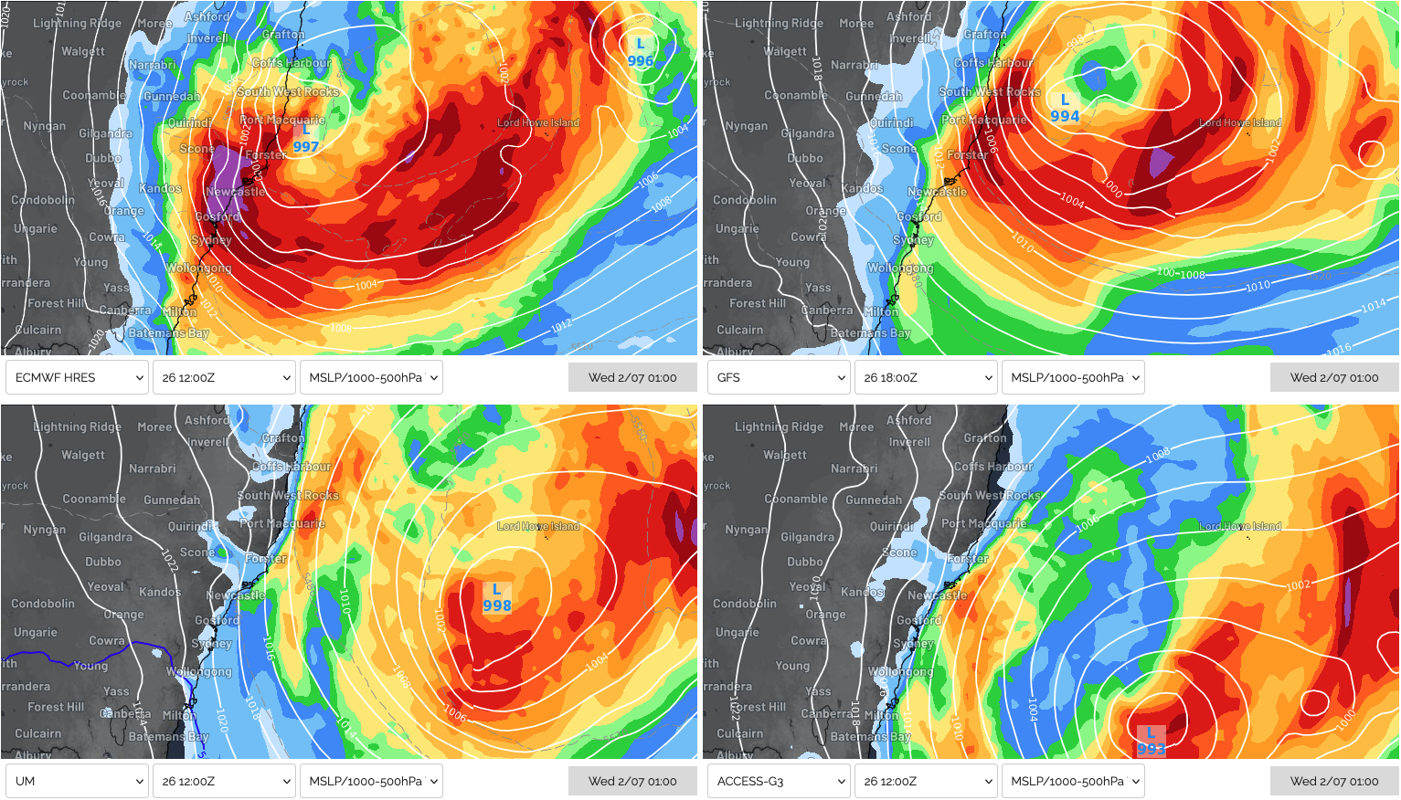
The system is expected to deepen off the northern NSW coast on Monday, June 30, with showers and fresh winds intensifying throughout the day. By Tuesday, July 1, the low-pressure system could evolve into a full-fledged East Coast Low, bringing severe weather. According to the latest models, rainfall accumulations of 100-200mm are expected over a 36 to 48-hour period, with areas such as the Mid North Coast and Hunter regions potentially receiving up to 300mm of rain.
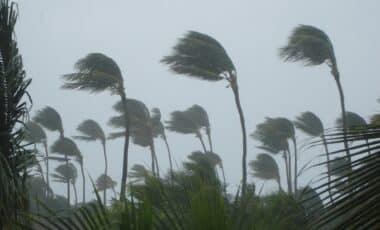
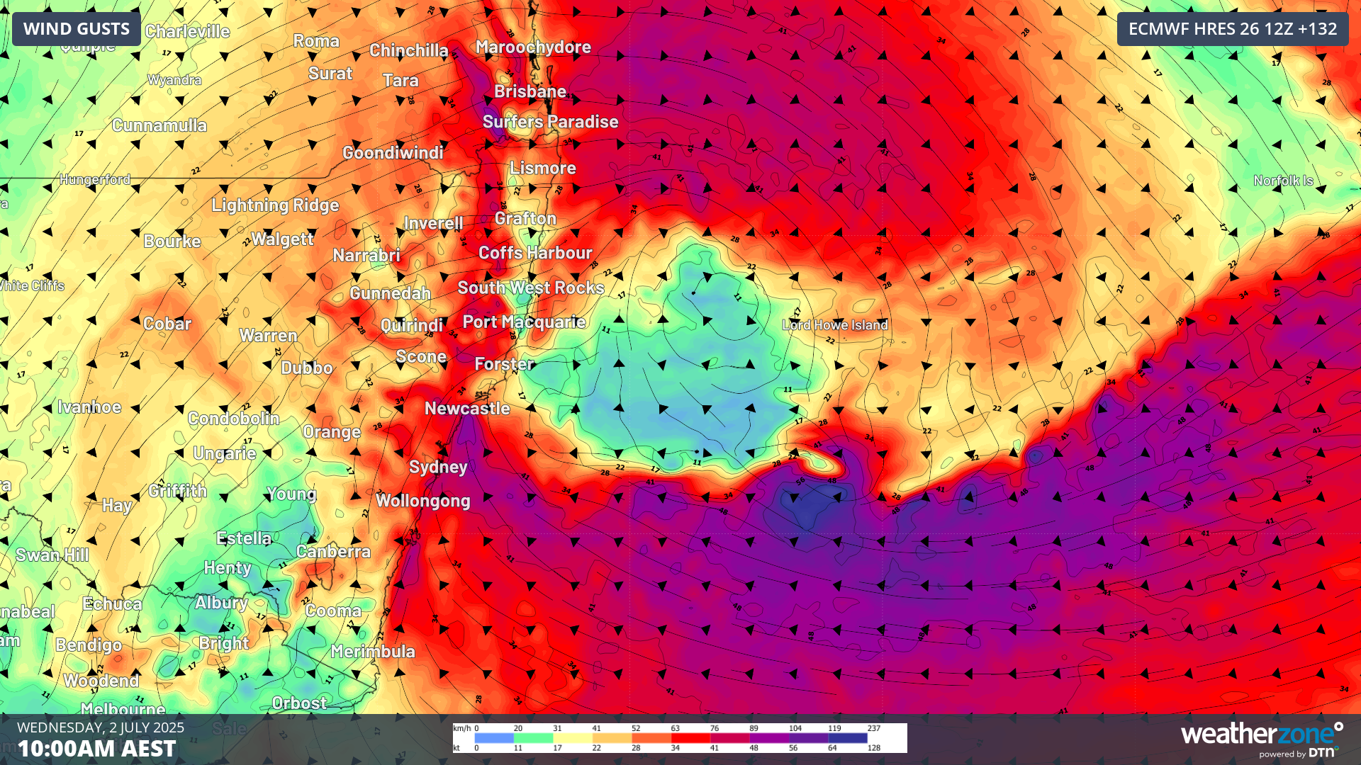
Winds will also strengthen as the system develops, with gusts exceeding 100 km/h expected along coastal areas between Forster and Jervis Bay. The most intense winds are predicted to occur on Wednesday, July 2, and could last into Thursday, causing disruptions in affected areas.
Coastal Impact: Erosion and Large Waves
In addition to the heavy rain and strong winds, the East Coast Low will generate large waves across the Tasman Sea. Significant wave heights of 5 to 6 meters are forecast to impact coastal regions from Sydney to the Mid North Coast, with maximum wave heights potentially reaching 13 meters. These large waves pose a significant risk of coastal erosion, particularly in vulnerable areas such as Collaroy Beach and Wamberal Beach, both of which have experienced erosion from past storms.
As the waves approach, the high tide cycles next week are expected to be moderate, which may limit some of the worst-case scenarios for coastal erosion. Nevertheless, the risk of damage to beachfront infrastructure and natural landscapes remains a serious concern. Local authorities are advising coastal communities to remain alert and take precautions to minimize the impact of this extreme weather event.
Factors Contributing to the East Coast Low
Several atmospheric and oceanic factors are contributing to the development of this East Coast Low. One key factor is the presence of warm sea surface temperatures (SST) in the Tasman Sea. SSTs in this region are currently 2 to 2.5°C above average, providing ample moisture for the developing low-pressure system. This warm water helps fuel the low, contributing to its intensification.
Another factor is baroclinic instability, which occurs when cold air from inland regions pushes towards the coast, interacting with warmer oceanic air. This creates a conducive environment for the low-pressure system to strengthen rapidly. The presence of a blocking high-pressure system over the Tasman Sea is also helping to keep the low-pressure system close to the coast, prolonging the adverse weather conditions.
The final ingredient for intensification is the upper trough located over the Great Dividing Range. This upper-level feature aids the rising of air, which then gets transported through the atmosphere, further deepening the low-pressure system. These combined factors are creating an ideal environment for a significant weather event to unfold.