As Queensland braces for yet another dose of severe weather, Ex-Tropical Cyclone Koji is making its presence felt with heavy rain, strong winds, and a potential flash flooding risk. While the storm has been downgraded from a category 1 cyclone to a tropical low, it’s still packing a punch. For residents along the North Queensland coast, the worst might still be on its way.
Koji Brings the Storm to North Queensland
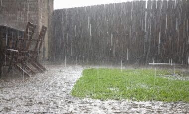
The system made landfall near Ayr, north of Bowen, early in the morning, and it didn’t take long before the Bureau of Meteorology (BoM) issued warnings about intense rainfall. Areas around Ayr and Bowen are expected to experience the heaviest downpours, which could lead to flash flooding throughout the day. Already, parts of the region have seen a staggering 370mm of rain, and the downpours are showing no signs of stopping.
Despite being downgraded, Koji is still a serious threat. The winds have been fierce, with gusts recorded as high as 113km/h at Hamilton Island before the storm crossed the coast. That’s no small feat, and for people in the affected areas, the combination of wind, rain, and possible flooding has created a tense situation.
Flash Flooding and Dangerous Winds
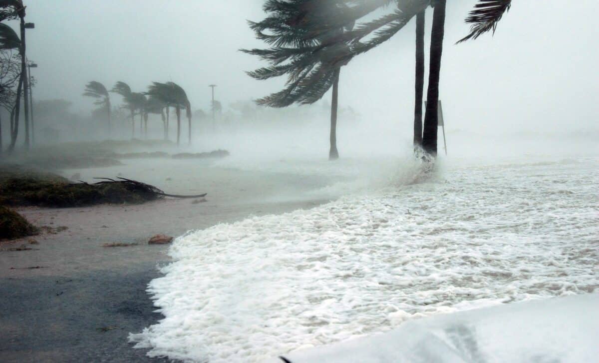
Residents in Queensland’s coastal areas are being urged to prepare for what could be a lengthy period of severe weather. As the storm continues its slow march southwards at 18km/h, more heavy rainfall is expected, and the danger of flash flooding remains high. The BoM has warned of local wind gusts of up to 90km/h, which could cause property damage and disrupt daily activities.
And it’s not just the rain and wind causing havoc. The storm is exacerbating already swollen catchments, meaning any additional rainfall could rapidly overwhelm rivers and floodplains. Queensland Premier David Crisafulli issued a stark warning, saying that while the cyclone has been downgraded, the threat of significant rainfall is still very much present.
Rescue Operations and Ongoing Concerns
In the wake of Koji’s impact, several rescue operations have already been conducted. One family had to be airlifted to safety after their car got caught in floodwaters. Another incident involved two men being rescued after their boat capsized in the wild weather. These stories highlight the dangers of being caught off guard in such conditions, and the state’s emergency services have been working around the clock to keep people safe.
Meanwhile, agricultural damage is mounting. The cyclone’s effects have already caused significant losses, with reports of up to 45,000 cattle lost in the floods. The economic toll on local farmers and ranchers is expected to be severe, as they try to salvage whatever remains of their livelihoods. The premier mentioned that veterinary supplies and fodder were being rushed to affected regions to prevent further losses.
What’s Next for Queensland?
As the storm continues to move south, Queenslanders are being urged to stay informed and heed the warnings from local authorities. Townsville’s airport has now reopened, but many other areas are still facing significant disruptions. The BoM’s warning zone now stretches from Ayr down to Mackay, including the Whitsunday Islands and Bowen.
While the storm may have weakened in intensity, the dangers it poses aren’t over. Residents should keep a close eye on weather updates, and anyone in the affected zones should prepare for continued severe conditions.