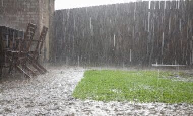
August 2025 has seen record-breaking rainfall across New South Wales (NSW), with over 20 locations already surpassing their highest-ever August totals. According to The Guardian, towns like Upper Allyn and Taree have experienced rainfall nearly double their usual amounts. With more rain expected, forecasts predict above-average rainfall will continue into spring, further disrupting the state.
Record Rainfall Shatters August Records Across New South Wales
August 2025 has proven to be a historic month for rainfall in New South Wales (NSW), with more than 20 locations surpassing their highest-ever rainfall totals for the month. As of August 22, Upper Allyn in the Hunter region recorded 277mm of rain, breaking the previous record of 202mm from 1987. Similarly, Taree Airport on the mid-north coast reached 240mm, well above its previous record of 151mm from 1998. Other areas, such as Collaroy in northern Sydney and Norah Head on the Central Coast, have also seen massive rainfall, with totals of 413.5mm and 403.8mm, respectively—well above their previous records of 215mm and 218mm set in 2014. This surge in rainfall has contributed to Sydney’s wettest August in 168 years, with the city already surpassing 368mm by the 22nd.
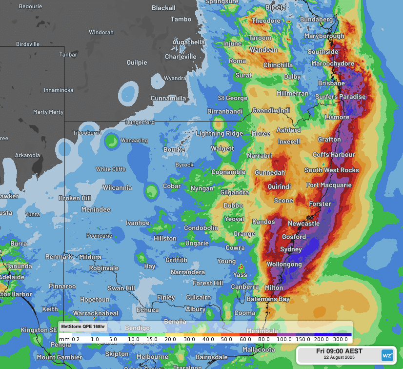
The heavy rain has triggered widespread flooding across the state. By Saturday, August 23, around 30 flood warnings were still in place, particularly along the Namoi, Hawkesbury, and Gwydir rivers. Flood-prone areas, including Gunnedah and Boggabri, were put under watch and act alerts. Emergency services have been working non-stop, responding to more than 1,000 incidents, including 16 flood rescues. Additionally, Sydney’s major dams, including Warragamba, have reached full capacity, with water being released into the catchment area to prevent further risk of overflow.
The Outlook: More Rain Expected, Spring Likely to See Above-Average Rainfall
The heavy rainfall is expected to continue throughout the month of August, with cold fronts forecast to bring further rain and thunderstorms to NSW next week. The Bureau of Meteorology has indicated that this pattern is unlikely to subside soon, with predictions of above-average rainfall for much of NSW through spring. “Spring rainfall is likely to be above average over much of NSW, with October showing the highest likelihood,” said Bureau of Meteorology climatologist Qian Zhou. “Large parts of northern and central NSW, and small parts of the south, face an increased chance of unusually high rainfall.”
The ongoing wet conditions are indicative of the broader trend of more extreme weather patterns in the region, likely influenced by climate change. As the state grapples with ongoing flood risks, emergency management teams are preparing for further rain and potential disruptions. Despite the ongoing challenges, experts remain focused on managing the immediate flood risks, while also planning for future storms and rainfall events in the coming months.