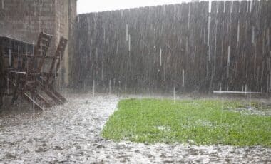
A significant cold front is currently sweeping through Western Australia, with severe weather warnings issued across several regions. As the system tracks eastward, it is expected to bring heavy rain, thunderstorms, and damaging winds to the state. The Bureau of Meteorology has alerted residents of affected areas to prepare for the incoming weather, which is expected to last through the weekend and intensify as it moves toward South Australia.
In particular, Perth and surrounding areas have already begun to feel the impact, with rainfall and storm conditions expected to worsen. This system, while not expected to bring massive amounts of rain to South Australia, could still disrupt conditions in the southeast, including Adelaide, as it tracks eastward over the coming days.
Severe Weather Warnings for Western Australia
The Bureau of Meteorology (BOM) has issued severe weather warnings for parts of Western Australia, including the Lower West, South West, Great Southern, Central Wheat Belt, and Greater Perth areas. The cold front has already triggered showers and thunderstorms along the southwest coast, and more are expected to develop as the system moves inland.
Areas like Busselton have already recorded significant rainfall, with 27mm by Sunday morning, and Bunbury has seen over 11mm. Perth, meanwhile, has received lighter rainfall, with 2.6mm recorded by 9am. Despite the lighter totals in Perth, experts anticipate that the rain will pick up in the coming hours, with as much as 25-30mm expected by Sunday evening. The BOM has also issued warnings for potentially damaging wind gusts associated with the storms, which could further complicate conditions.
⛈️⚠️ Severe Thunderstorm Warning issued for a line of storms south of Perth, affecting Mandurah, Bunbury and Busselton and surrounding areas at the moment.
— Bureau of Meteorology, Western Australia (@BOM_WA) July 27, 2025
Details: https://t.co/NikaX4QRKr pic.twitter.com/ZKMjHvqJbh
Impact on Perth and the Surrounding Areas
Perth is set to experience another round of heavy rain and storms as the cold front moves through. According to Sky News weather presenter James Preston, the cold front is pushing a thick band of cloud across the region, bringing with it substantial rainfall and more intense weather. The storms are expected to affect Perth by the late morning and continue into the evening.
The forecast for Perth includes the potential for significant rainfall amounts, with 25-30mm expected by the time 9am rolls around. This will significantly impact the region, especially with ongoing thunderstorm warnings for the area. As the system continues moving eastward, other areas along the southwest coast are also bracing for wet conditions.
System Moving Toward South Australia
As the cold front moves further east, South Australia will begin to experience its effects, although the storm’s intensity is expected to lessen. The system is predicted to reach Kalgoorlie by Sunday evening, and the cold front will push toward South Australia by Monday, with Adelaide expected to see rainfall by Monday night.
While Adelaide is not expected to experience heavy rainfall, light showers of around 3mm are anticipated. This marks a significant change in conditions for the southeastern part of the country, with the weather set to shift dramatically as the front moves eastward.

Ongoing Weather Developments
The cold front will continue its eastward trajectory, with another cold front expected to emerge late on Monday evening and into Tuesday. The ongoing weather system could cause disruptions, especially in agriculture and local infrastructure in affected regions. While the system is unlikely to cause widespread flooding, localized flooding remains a risk, especially in areas already experiencing significant rainfall.
The situation is being closely monitored by local authorities and meteorologists, and further warnings may be issued as the system progresses. Residents in the affected regions are encouraged to stay updated on weather alerts and take necessary precautions.