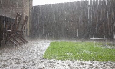
A massive weather front spanning thousands of kilometers is sweeping across Australia, bringing with it record-breaking rainfall and marked temperature contrasts. The widespread cloud band has already affected regions from the Kimberley in Western Australia to New South Wales, disrupting communities still recovering from earlier floods.
The developing system has intensified concerns in flood-prone zones and caught meteorologists’ attention due to the unusually high rainfall figures being recorded for May. The contrast between drenched inland areas and colder southern cities marks one of the most dynamic weather patterns of the season so far.
Extreme Rainfall Impacts Outback and Northern Regions
Satellite images show a cloud band stretching over 3,600 kilometers from Western Australia’s Kimberley region through the Northern Territory and into Queensland and New South Wales. The northern and central regions of Australia are seeing rainfall levels rarely experienced in May.
In Broome, Western Australia, 100.6mm of rain fell within 24 hours—its highest daily total for May in two decades. Further north, Kalumburu recorded 111.6mm and Wyndham received 54.8mm, both setting new May rainfall records. The Northern Territory has also seen exceptional figures, with Tindal receiving 179.8mm in a day—far exceeding the area’s monthly average of just 2mm. Rabbit Flat logged 77.6mm and Alice Springs recorded 40.4mm, marking its highest May daily total since 1993.
New South Wales, Still Reeling from Prior Flood Damage
While the brunt of the current weather system is focused on central and northern areas, New South Wales remains in recovery after being hit by devastating coastal floods just a week prior. The earlier storm systems left towns like Taree and Port Macquarie dealing with debris and disrupted transport routes, and many communities remain vulnerable.
With the ground still saturated from previous rainfall, authorities are monitoring developments closely. Although the incoming weather system is not forecast to bring heavy rain to NSW’s east coast this weekend, continued rainfall elsewhere could increase downstream pressure on the region’s river systems.
Old poo fingers is gonna be excited big old cloud band from North WA is currently being pushed across the country bringing rain to coastal QLD in the next few days. Rainfall totals will be dependent on the interaction with a surface trough close to the coast… pic.twitter.com/np1aPeVAKP
— ☘️ jackie london 🏴 (@Yerrk61783) May 27, 2025
Weekend Forecast Varies Across Major Cities
Forecasts for the weekend indicate differing impacts across Australia’s capital cities. Sydney is expected to experience stable weather, with mostly sunny conditions and only a 10–20% chance of rain from Friday through Sunday, accompanied by temperatures peaking at 20°C.
In Brisbane, the risk is notably higher. Showers are expected Friday, with a potential for up to 6mm of rainfall. Saturday could bring up to 15mm, with rain likely across the city, before tapering off into possible showers by Sunday.
Melbourne will see cloud cover and light rain, with a 50% chance of showers on Friday. The forecast remains overcast for Saturday and partly cloudy by Sunday, with temperatures fluctuating between 9°C and 17°C.
Central Australia Braces for Further Rainfall
Outback and interior regions are again bracing for potential disruption. Already this year, communities in central Australia have been cut off by temporary inland seas created by earlier flooding. The town of Thargomindah, located in outback Queensland, was among those isolated earlier in the season.
Meteorologists warn that with more rainfall expected in these remote zones, further isolation of towns is possible. Roads that connect these communities to broader transport networks remain vulnerable, especially where recent floodwaters have yet to fully recede.
Perth and Western Coastline See Heavy Showers and Storm Risk
Western Australia continues to experience heavy rainfall and storm activity as the cloud band moves east. In Perth, Friday’s forecast includes thunderstorms and rain between 6mm and 20mm, with a 95% likelihood of precipitation. Showers will persist over the weekend, with expected totals ranging from 2mm to 9mm on Saturday and up to 2mm on Sunday.
Other southern cities such as Adelaide, Canberra, Hobart, and Darwin are forecast to have relatively calm and dry conditions, with minimal rainfall expected. Canberra will face cold morning temperatures and frost, particularly on Friday and Sunday, with lows dropping to -1°C and 0°C respectively.
As the system continues to move, local authorities across affected states are maintaining alerts and encouraging residents in low-lying or flood-affected areas to remain informed and prepared.