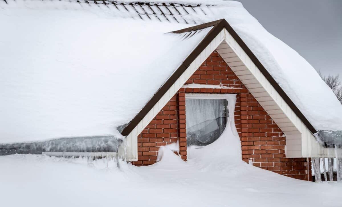
Federal meteorologists have placed parts of Washington State under a heavy snow warning, with forecasts calling for up to 12 inches of accumulation and winds reaching 35 mph across select mountain communities. The National Weather Service is urging residents and drivers to take immediate precautions as conditions are expected to persist through Thursday morning.
The warning comes as a convergence of heavy snowfall and sustained winds raises the prospect of widespread disruptions, from hazardous road conditions to downed power lines, across some of the state’s most vulnerable corridors. Officials have stopped short of declaring an emergency, but the language from weather authorities has been notably direct.
Where Washington Faces the Greatest Risk
The brunt of the storm is expected to fall across the Cascades of Snohomish and Whatcom counties, as well as northern King and Skagit counties, where between 8 and 12 inches of snow are forecast by Thursday morning. Communities at higher elevations will bear a disproportionate share of the impact.
Areas including the Loup Loup Pass, Mazama, Conconully, Stevens Pass, Methow, Stehekin, Twisp, Winthrop, and Holden Village are projected to receive an additional 8 inches of snowfall in locations above 4,000 feet, particularly along Stevens Pass, while lower-lying areas in the same region can expect between 1 and 3 inches.
The combination of accumulation and wind is expected to produce blowing snow conditions that could significantly reduce visibility and render travel “very difficult,” according to the National Weather Service, which has specifically urged drivers to reduce speed and exercise heightened caution until conditions improve.
Beyond road hazards, forecasters warn that the storm’s intensity could bring down tree branches and power lines, raising the possibility of outages across affected communities.
How Residents and Drivers Are Being Advised to Prepare
Emergency preparedness guidance has taken on added urgency given the dual threat of travel disruption and potential loss of power. According to Ready, the U.S. government’s official emergency preparedness platform, households should assemble emergency kits before conditions deteriorate, stocking multiple flashlights with spare batteries, a battery-powered radio, a fully charged portable power bank, several days of non-perishable food and drinking water, and any required medications.
For those who lose power, officials recommend keeping curtains closed to retain indoor heat and placing towels along door thresholds to prevent cold drafts from entering. Generators, should they be used, must be operated exclusively outdoors and kept well clear of windows to eliminate the risk of carbon monoxide poisoning, a danger that spikes during winter outages as residents reach for alternative heating sources.
On the roads, the National Weather Service advises that drivers avoid all non-essential travel during the storm. Those who must travel are encouraged to ensure their vehicles are equipped with quality tires, full fuel tanks, and emergency supplies including blankets, food, water, and a shovel. Should a vehicle become stranded, drivers are instructed to remain with it, run the engine intermittently for warmth, and keep the exhaust pipe clear of snow buildup to prevent dangerous fume accumulation inside the cabin.