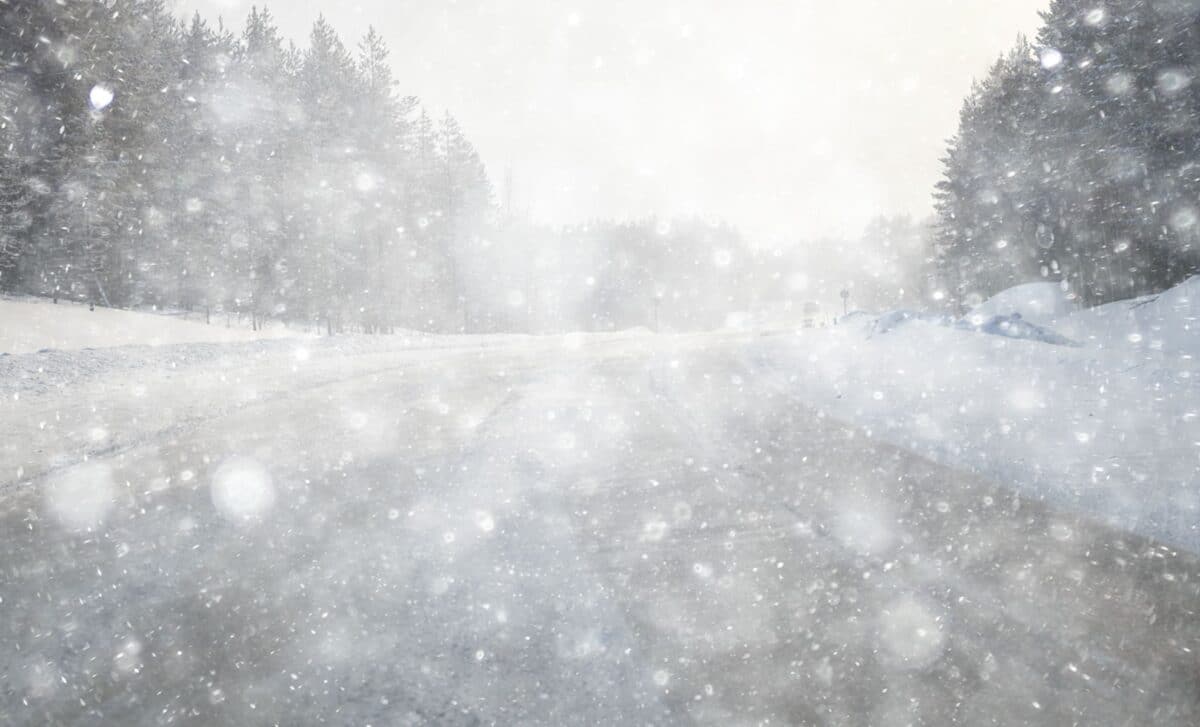
Powerful winds, heavy snowfall, and dangerous whiteout conditions are expected across parts of the northern and western United States, prompting officials to urge residents to remain indoors as the storm intensifies.
A powerful winter storm is forecast to sweep across wide sections of the United States, bringing heavy snow, strong winds, and hazardous travel conditions to several states. Authorities have warned that some areas could receive as much as 30 inches of snow as the system moves through the northern and western parts of the country.
The National Weather Service (NWS) has issued warnings affecting nine states, including Alaska and Hawaii, with officials advising residents to stay indoors until weather conditions improve. The storm is expected to create blizzard conditions in several regions, with travel likely to become difficult or impossible in the hardest-hit areas.
Heavy Snowfall and Powerful Winds Expected across the Midwest
Parts of the Midwest are expected to experience some of the most severe conditions as the storm progresses through the region. Wisconsin, in particular, could see significant snowfall totals combined with high winds that may drastically reduce visibility.
According to the National Weather Service, counties in northern Wisconsin including Oneida, Vilas, Florence, Forest, Marinette, Oconto, Door, Marathon, Langlade, Lincoln, Menominee, and Shawano could receive between 20 and 30 inches of snow accompanied by wind gusts reaching 50 miles per hour. Officials warn that these conditions could create whiteout situations and make travel extremely dangerous through Sunday and into Monday afternoon.
Elsewhere in the state, snowfall totals are also expected to be substantial. Manitowoc, Kewaunee, Calumet, Winnebago, Brown, and Outagamie counties could receive up to 20 inches of snow along with strong winds, while Portage, Waushara, Wood, and Waupaca counties may see between 13 and 22 inches. According to forecasts, these conditions could lead to blizzard-like environments with blowing and drifting snow.
Minnesota is also expected to experience severe weather. Southeastern parts of the state may receive up to 9 inches of snow with winds reaching 55 miles per hour. The National Weather Service has warned that these conditions could lead to power outages and make travel nearly impossible in some areas.
Severe Conditions Extend from the Great Plains to Alaska and Hawaii
The storm’s impact will not be limited to the Midwest. Several states across the northern Plains and mountainous regions are also expected to face dangerous weather conditions, including strong winds and heavy snowfall.
In Michigan, areas around Mackinac and nearby islands such as Bois Blanc and Beaver Island could receive between 14 and 30 inches of snow. Wind gusts near 50 miles per hour are forecast to continue in the region until Tuesday morning, according to the National Weather Service. Northern parts of Michigan’s Lower Peninsula may also see snowfall totals of up to 15 inches before conditions begin to ease.
South Dakota is forecast to experience a combination of snow and high winds that could sharply reduce visibility. According to the National Weather Service, some counties including Day, Marshall, and Roberts may receive up to 18 inches of snow with wind gusts near 50 miles per hour. Forecasters have warned that visibility could drop below half a mile, creating hazardous travel conditions in open areas.
Further west, Wyoming’s Black Hills region is expected to receive around 6 inches of snow with winds reaching 40 miles per hour. Meanwhile, parts of Alaska such as the city of Hyder could see between 14 and 20 inches of snowfall through Sunday and into Monday morning.
Even Hawaii is included in the warnings. According to the National Weather Service, the summits of the Big Island could receive up to 20 inches of snow with wind gusts reaching 100 miles per hour. Officials have advised that any travel plans to these high elevations should be postponed due to the potential for zero visibility.