A large winter storm is unfolding across much of the country, stretching from the Southern Rockies to the Northeast. The system is expected to deliver multiple forms of winter weather over several days, affecting millions of residents and major transportation corridors.
A Multi-Day Storm With Snow, Ice, And Freezing Rain
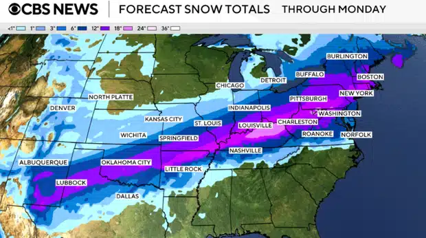
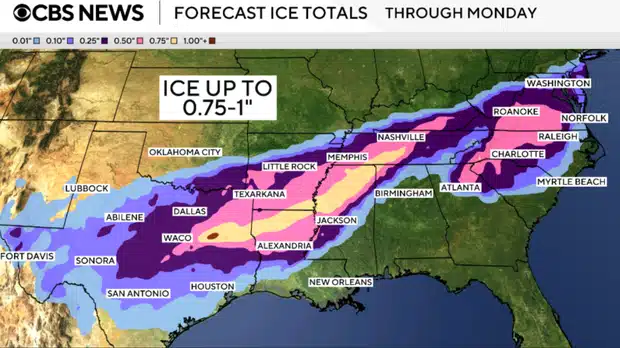
According to CBS News, meteorologists are tracking a sprawling winter system that is notable for both its size and duration. The storm is forecast to persist through Monday, with different regions experiencing snow, sleet, and freezing rain as temperature profiles shift. The National Weather Service warns that the combination of precipitation types increases the risk of dangerous conditions over a wide area.
“A significant, long-duration winter storm will bring widespread heavy snow, sleet, and freezing rain from the Southern Rockies to New England through Monday,” the National Weather Service says.
Snowfall totals are expected to be highest in parts of the central Plains, Midwest, and interior Northeast, where cold air remains firmly in place. In southern and transition zones, warmer air aloft may lead to sleet and freezing rain, increasing the threat of ice accumulation. These conditions can quickly overwhelm road crews and complicate emergency response efforts. Forecast models show that even small shifts in temperature could change precipitation types, making local impacts difficult to pinpoint until the storm is underway.
Travel And Infrastructure Disruptions Expected To Mount
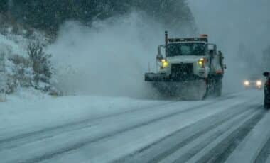
As the storm advances eastward, transportation networks are likely to face mounting strain. Major highways, regional airports, and rail corridors intersect the areas expected to see the heaviest snow and ice. The National Weather Service cautions that “Widespread travel disruptions, prolonged power outages, and vast tree damage is likely.”
Ice accumulation on power lines and trees remains a primary concern, especially in areas that experience freezing rain for several hours. Even moderate ice buildup can lead to snapped branches and downed lines, cutting electricity to large numbers of customers. Snowfall rates may also reduce visibility to near zero at times, increasing the risk of accidents. Officials in several states have urged residents to delay nonessential travel and prepare for the possibility of extended outages as repair crews contend with hazardous conditions.
Northeast And New England Brace For The Final Push
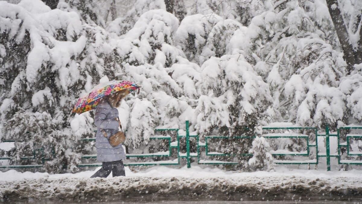
Later in the storm’s life cycle, attention turns to the Northeast and New England, where cold air is expected to support accumulating snow. Urban corridors could see slower commutes and service interruptions as the system reaches its peak. Forecasters emphasize that the storm’s long duration sets it apart from faster-moving winter systems, raising the likelihood of cumulative impacts rather than a brief disruption.
Snowfall combined with gusty winds may produce blowing snow and localized whiteout conditions, particularly in open and elevated areas. Coastal regions may face a mix of snow and sleet, while inland locations could remain all snow. Emergency managers continue to monitor forecasts closely as small changes in track and temperature may alter the balance between snow and ice, with significant consequences for safety and infrastructure.