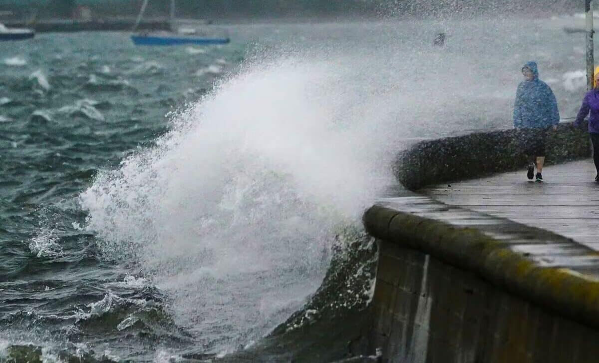
The UK is struggling with the aftermath of Storm Kathleen, which caused havoc to transport and electricity services across the country.
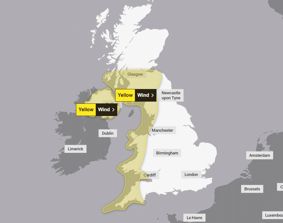
Storm Kathleen slammed into the UK, causing gusts of up to 70mph and prompting the Met Office to issue a yellow weather warning. The worst affected areas are parts of Northern Ireland, Scotland, Wales and parts of the North West and South West of England.
Interestingly, the storm has also brought a rise in temperatures, with the mercury expected to reach 22°C (71.6°F) in the east of England. Met Office meteorologist Ellie Glaisyer says the storm’s location in the west of the UK brings southerly winds across the country, carrying warmer temperatures from the continent.
“The further west you are, where those strongest winds are in that yellow warning area, despite the temperatures being above average it will feel a little colder.” added Ellie Glaisyer.
🌧️ As well as strong winds, #StormKathleen is bringing heavy rain to parts of Wales and southwest England this evening
🚗 Take care if you are travelling as there could be localised flooding and disruption pic.twitter.com/TVWG2kPngQ
— Met Office (@metoffice) April 6, 2024
Storm Kathleen Hits Travel Network
Approximately 70 flights to and from UK airports have been cancelled due to the storm. In particular, Belfast City Airport in Northern Ireland was affected, with all Aer Lingus flights cancelled.
There were also disruptions to rail and ferry services. Ferry services to and from the Isle of Man were suspended, and P&O Ferries cancelled services between Larne in Northern Ireland and Cairnryan in Scotland.
In addition, the storm has led to sports matches being rescheduled. The EPCR Challenge Cup match between Edinburgh Rugby and Aviron Bayonnais had to be moved from the Hive Stadium to the Scottish Gas Murrayfield Stadium.
Power Outages
The storm caused around 34,000 households to lose power. The main areas affected were Mayo, Galway, Kerry and Cork.
The Environment Agency issued more than 110 flood warnings across England. RAC Breakdown has also urged drivers to avoid exposed coastlines and higher roads, where the impact of strong winds is likely to be most visible.
“This intense period of storm activity is going to prove extremely challenging for anyone driving in the west of the UK,” said Rod Dennis, spokesman for RAC Breakdown.
- To View the Flood Zones Map
- Find Out About Flooding Near You
- Scottish Flood Forecast
- Wales Flood warnings and alerts
Warnings in Ireland
Met Éireann, Ireland’s meteorological service, has warned of southerly gales, potentially leading to difficult travel conditions, falling trees, power outages and flooding along coastal areas.
Keith Leonard, from the National Directorate for Fire and Emergency Management (NDFEM), advised people to stay away from coastal areas for the duration of the warnings.
“It is important to remind people that it is essential never to touch or approach downed electrical wires,” warned Keith Leonard, urging people to contact ESB Networks.
Evening Weather Forecast
Steady and strong winds will continue this evening, especially in the west. Some rain expected tonight from the south-west, at times heavy with risk of thunderstorms, but moving rapidly north-eastwards. Generally dry, with clear spells elsewhere towards dawn.
Sunday
Breezy, especially over north-west Scotland. Chances of showers, though the weather will remain dry and sunny. Warm in the south-east. Temperatures likely to be near average in the north-west.

