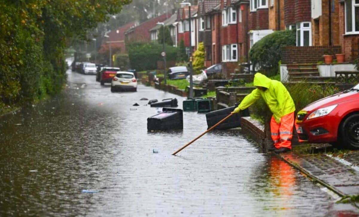
This February’s record rainfall has led to severe flooding across the UK, with flood warnings in place in many regions. Entire towns have been submerged, homes evacuated, and roads rendered impassable.
Record-Breaking February Rainfall Causes Floods Across the UK
The United Kingdom experienced extremely heavy rainfall throughout February, breaking records and causing widespread flooding. According to the Met Office, the country received almost a third more rain than the average for February.
The Environment Agency issued over 200 flood warnings and alerts, with rivers in southern England and parts of Worcestershire expected to overflow, causing flooding of lands, roads, and properties. Central and southern England were particularly affected by the heavy rainfall.
The flooding is expected to cause significant travel disruption and property damage. Disruptions and property damage, leading to road closures, cancelled trains, and flooded homes across wide swaths of the country.
The Met Office stated that the rain and cloud would sink southeast through the day, though weakening as it went, with sunny spells and blustery showers to follow behind. Wet and windy conditions are likely to continue over the next few days.
Weather Forecast for Tonight and this Week
A patchwork of rain and drizzle blankets England and Wales as Tuesday turns to evening. But clarity is on the horizon as the night progresses, with showers drifting into the surrounding regions. In Scotland, showers persist, especially in the north, highlighting the diverse weather across the UK.
Rain will gradually clear the southeast this evening 🌧️
Fog patches will begin to form across southern England and Wales after dark 🌫️
Clear spells and showers in the north 🌙 pic.twitter.com/TcAJ0RiRKS
— Met Office (@metoffice) February 27, 2024
Rainy Wednesday Across Northern Regions
Northern Ireland and Western Scotland are waking up to wet conditions this Wednesday morning, thanks to a persistent rain front. This inclement weather extends across the northwest of England and Wales, and ventures towards the Midlands and Eastern Scotland.
Although it is a damp start, there is a glimmer of relief as some areas experience slight clearance, but this is accompanied by lingering cloud and scattered showers.
Midweek : Rain, Fog and Cold Air
As Wednesday progresses, there will be a transition marked by the arrival of a ridge, heralding foggy conditions across central and southern England and Wales. As the rain dissipated, colder temperatures set in.
Alongside this atmospheric shift, however, a more dynamic weather system is lurking on the horizon, ready to bring wintry showers and heavier rain pulses on Thursday.
A more active weather front will arrive on Thursday, unleashing torrential downpours accompanied by strong winds across the north of England, Wales and the West Country. The front will also bring colder air, which will intensify showers and could lead to snow on hills and mountains.
Thursday’s Outlook : Strong Winds and Wintry Showers
A more active weather front will arrive on Thursday, unleashing torrential downpours accompanied by strong winds across the north of England, Wales and the West Country. The front will also bring colder air, which will intensify showers and could lead to snow on hills and mountains.
Friday Brings Colder Conditions and Snowfall
As the week draws to an end, a noticeable change in the weather dynamic will occur on Friday, as a band of rain will cross the country, targeting the northern regions in particular. Snowfall is expected in the hills and mountains, and possibly even at lower elevations.


